Bike Plan Update Includes Options for Completing the Lawrence Loop
The City of Lawrence is updating it’s bike plan, and the steering committee overseeing the update has made completing the Lawrence Loop a high priority! An online survey and an Open House at the Lawrence Library on Monday, February 2, from 4:30-6:30pm, are two opportunities to provide input on preferred alignments to complete the three remaining gaps in the Loop. We encourage you to get involved!
The Board of Friends of Lawrence Area Trails (FLAT) has chosen to endorse the following alignment options:
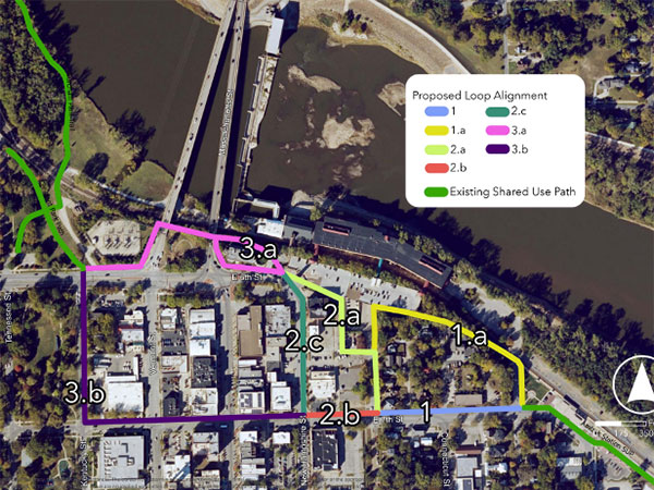
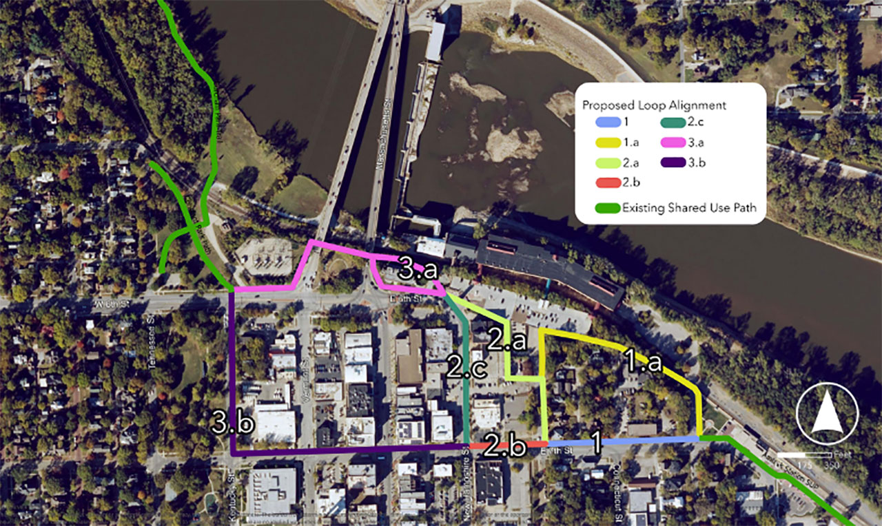
Downtown Connection: 1a, 2a and 3a. This route would pass behind City Hall and underneath the bridges to North Lawrence. This route would have the greatest separation from roadways and the safest, most comfortable means of getting across downtown on foot or bike.
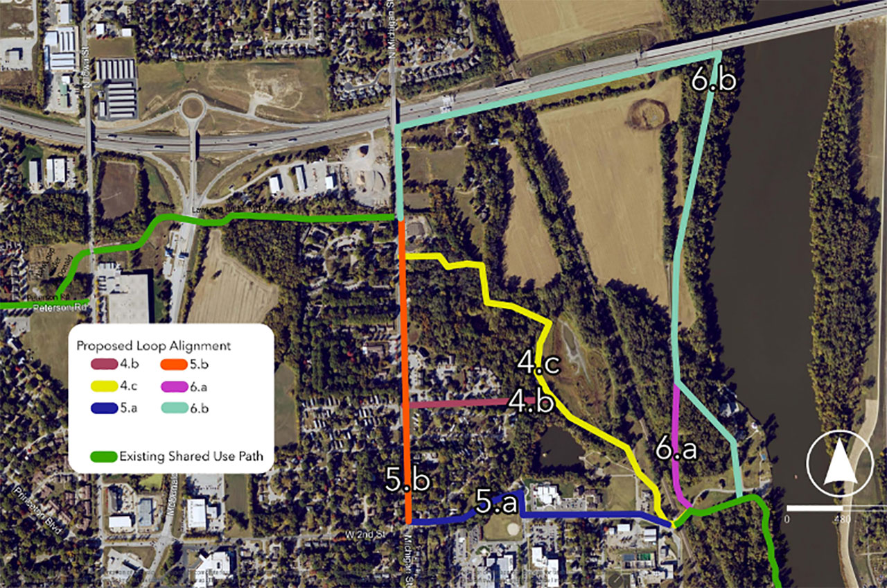
Northeast River Connection: 6a and 6b. Route 6 is most consistent with the overall character of the Loop, providing a safe, pleasant experience for trail riders. It would provide easy access to Cameron’s Bluff, where efforts are underway to build new river trails. The “4” routes have challenges associated with land acquisition (the city already returned grant funds to the state because they were unable to overcome similar barriers), and Route 5 would be difficult to construct without relying on “on street” infrastructure, inconsistent with the overall nature of the Loop.
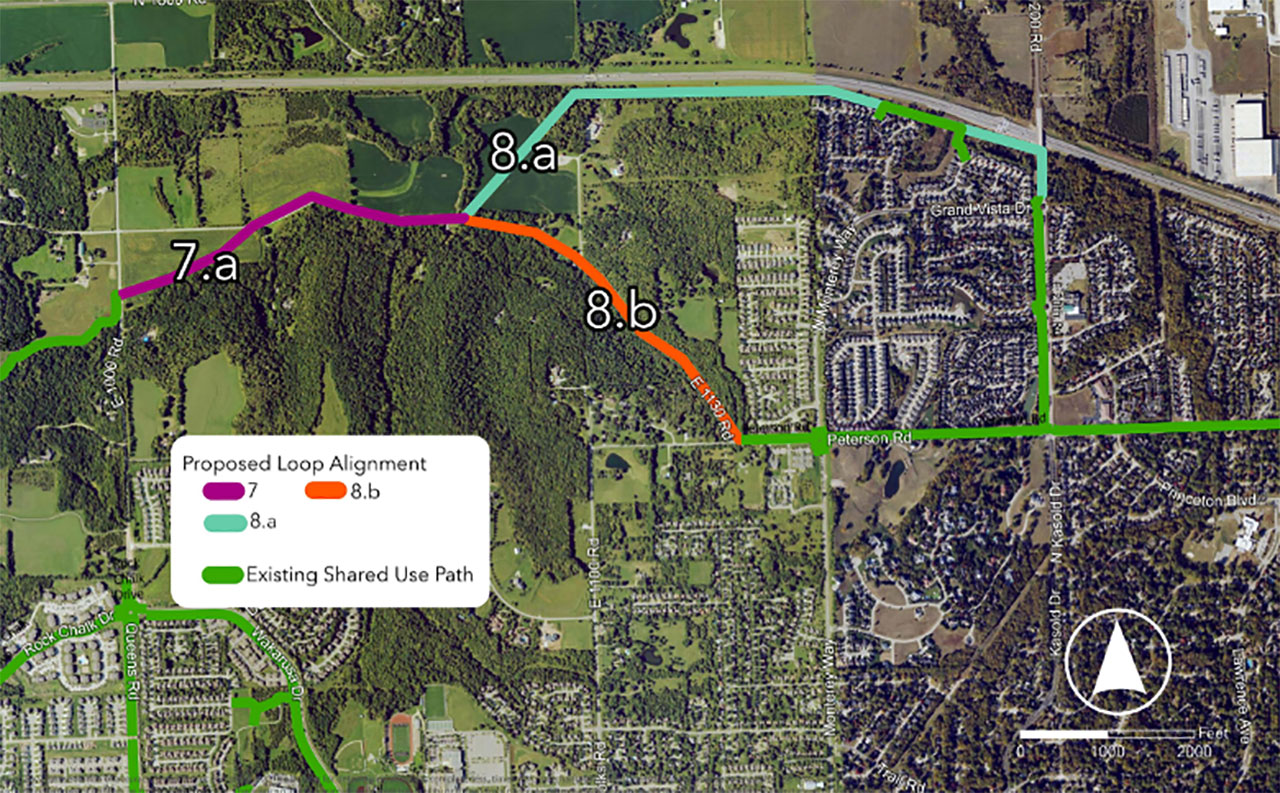
Northwest Corridor Connection: 7a and 8a. Option 8a avoids the steep grades associated with 8b, which would parallel E 1130 Road. Much of the trail would be built on land owned by the city and the Turnpike Authority, making it a feasible and cost-effective option.